Can you tell me where can you find two whole cities in the space of an inch? Of course, on a map but using a scale to find how far away any two points are on the map is not easy to demonstrate. Luckily, for you, Google Maps has an answer. The mapping tool has a neat little feature that allows you to calculate the distance between 2 points on Google Maps in a snap. So, if you’ve ever wondered how far your house is from the North Pole or the South Pole or ever wanted to calculate its distance on the map, you must try this feature.
How to calculate the distance on Google Maps between any 2 points?
Though Google Maps shows distance measurements when routing directions, most of those are confined to paths you’ll be taking along the route. This happens because the mapping tool’s algorithms are programmed to surface the fastest route to your destination, and it hardly represents a straight line. You can however fine-tune this arrangement and take measurements in a straight line by entering a starting point and selecting the Measure distance option. Here’s how to use it to calculate the distance on Google Maps between any 2 points.
In the Google Maps app for iOS, find your starting point. For most users it’s their Home (See how to change your Home on Google Maps). Tap your finger gently on the screen until a red bubble (inverted) appears on the location.
The address or name of the location should show up at the bottom of the app screen. Expand by tapping it to locate the Measure distance entry.
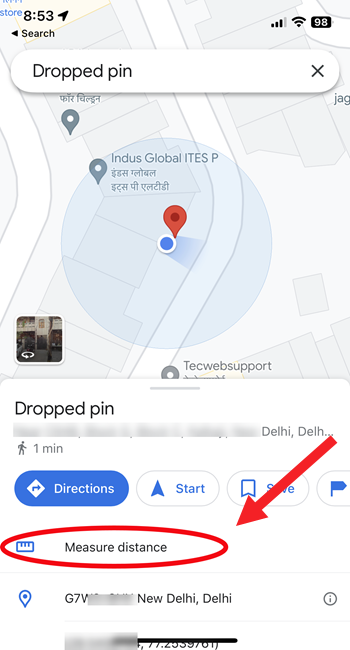
Slide over the map using your finger to put the black targeting circle to another point on the map.
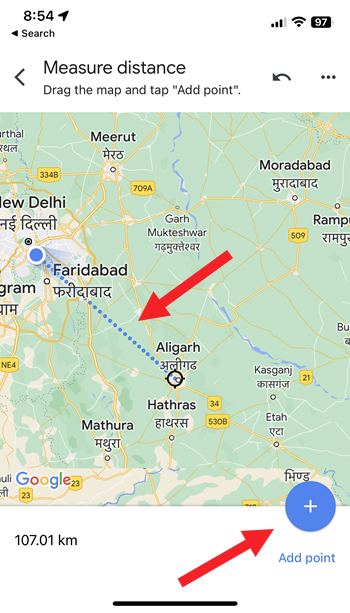
Hit the Add (+) button to link it to your first point. The calculated distance will be shown at the bottom of the screen.
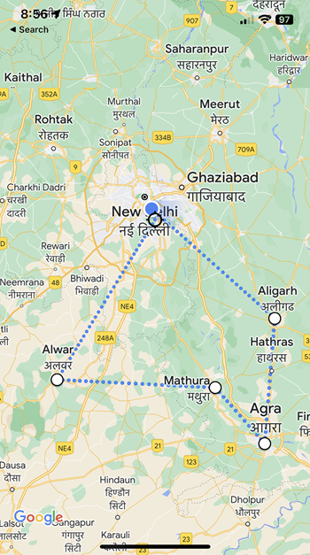
Add more points to the original location by repeating the process. When done, go to the More menu (visible as 3 dots) and select the Clear option to remove them all.
Measure distance on Google Maps Desktop
Go to Google Maps online and pick the location where you want to start the measurement. Right-click on the point and from the menu that appears, select the Measure Distance entry.
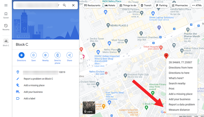
Click anywhere on the map to draw a line between the starting point and the destination point. The distance will show up inside a box at the bottom of your computer screen.
To choose a more complex route, click on the line and drag it into position at various points. Then, the total distance calculated between the start and end points will automatically adjust.
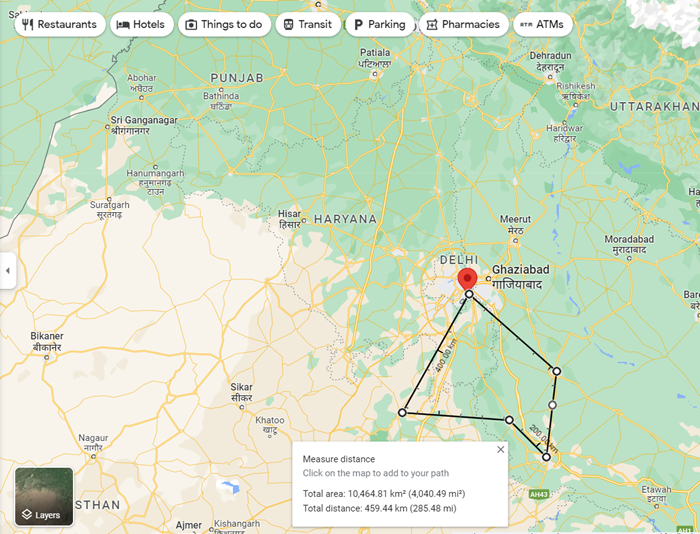
Click on marked points to remove them or hit the Close button (X symbol) in the distance measurement box. You can also make Google Maps delete history automatically.
The good thing is users aren’t confined to twisty lanes or streets. So, you can use the map to calculate the distance from one point to another, be it in the ocean or on the other side of the globe. Furthermore, you can drop down dozens of points, enabling the ruler to change directions.

